Sunday, October 11, 2015

Stockport Beer Week (Sept 24 - Oct 4)

This year was the inaugural Stockport Beer Week, organized by the Stockport and South Manchester branch of the Campaign for Real Ale (CAMRA) in collaboration with local CAMRA members, brewers, and Stockport's council.  I'm a CAMRA member, and I love beer, so trying to make it out to some of the week's events was a no-brainer for me.

Stockport is only about 7 miles southeast of Manchester.  Nowadays, that means it is all part of the jumbled sprawl that is the Greater Manchester metropolitan area, but back before the invention of cars, that was a far enough distance for Stockport to develop over the centuries as a town in its own right, with its own history and heritage.

It is actually faster for me to get from Altrincham to Stockport by train than it is for me to get to the city centre, but the trains only run once an hour, so it's just not as convenient.  Hence, I hadn't really spent much time in Stockport prior to this.  I bought my car at the Mercedes Benz dealer in Stockport, and I'd been to The Hope Inn once (The Hope is the home of the Fool Hardy Ales microbrewery).  I've passed through the railway station, and I've driven through the town.  Still, beer is always a good reason to explore a new area.

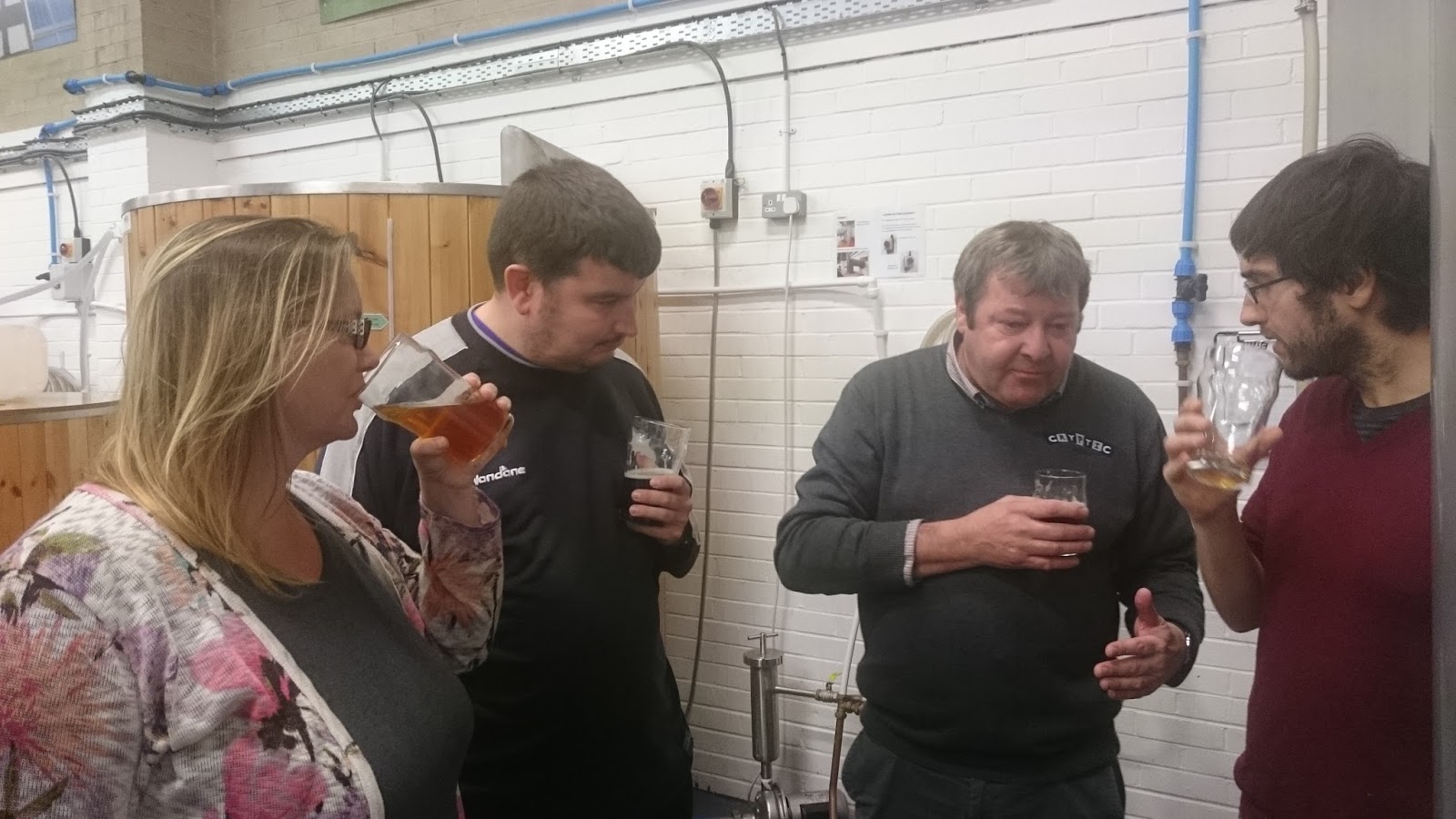
On Wednesday night (September 30), I met up with some beer buddies, and we started with an open house night at Cryptic Ales Brewery.  The brewery is about 1 mile walking from the Stockport train station, so I got in some exercise first.  The weather was exceptionally fine for a brisk walk.  Cryptic has only been in operation for about a year, and this was their first official "open house".  It had a really great space, and they had on some nice ales from their core range as well as a special ale brewed with ginger.  The ginger wasn't overpowering and actually gave it a nice bite.


Beer Buddies


Getting the obligatory "brewery tour" from Cryptic's brewer
The brewery was unfortunately the target of a robbery very early on.  The robbers broke in and stole all the equipment and electronics they could, and they still haven't been caught.  The cheeky bastards took a black marker and wrote on the office wall -- "Thanks for the free stuff!  :-)"  The owners of the brewery have left the graffiti up there.  The gall of it made me angry on their behalf.  At least they were covered by insurance, but still, what an awful way to get your business off the ground.

After the brewery open house wrapped up, we started to walk back towards the centre of Stockport.  We made a quick stop in at The Fairway Freehouse along with way.  It wasn't part of the official Stockport Beer Week agenda, but one of my beer buddies is the brewer at Tatton Brewery, and The Fairway had some of his beer on, so he wanted to check the place out.  Plus, a mile is a long way to walk without a beer.  It was a very nice establishment with a charming, cozy interior and a good selection of fine ales.

We passed by the Stockport Town Hall, a local Edwardian landmark that is affectionately known as "the wedding cake" because of its ornate, tiered, white facade.

The Wedding Cake
At this point, being a Wednesday night, I really should have caught the next train home.  Instead, it was time to make a bad decision and go to the next pub.  We ended the evening at The Spinning Top, a modern bar on the main thoroughfare of Wellington Road South that was going to have live music.  Happily, they had some of Tatton Brewery's special "Ruck and Maul" Porter on, and our group polished off the cask.  Tatton's "Ruck and Maul" was really, really good.  The Spinning Top also had pork pies, and since I hadn't had dinner, I took down a cold pork pie with Branston Pickle and cheese.  Delicious.

After we exhausted the cask ale options we liked, we did a couple of bottles.  They had a Young's Double Chocolate Stout available, which is a wonderful beer.  I'd only had it once before, and I was happy to find it again.  I ended up catching the very last train home at 11:27 PM.  Too much fun!

Friday, October 2 it was back to Stockport for Round 2 of Stockport Beer Week activities.  This time, I headed past the Spinning Top and further northwest along Wellington Road South (the A6).  This gave me my first chance to see the start of the River Mersey.  The Rivers Tame and Goyt flow in from the east, and their confluence is the Mersey.  Stockport is founded on three rivers.  There even used to be a 3 Rivers Brewing (that didn't survive the great recession).  As someone who lived in and loved Pittsburgh, Pennsylvania for 4 years, the confluence of three rivers parallel made me like Stockport even more.
The River Mersey, the Stockport Viaduct and a setting sun to the west.
We started with a quick Happy Hour at the Crown Inn, a lovely heritage boozer with a large beer patio underneath the landmark Stockport viaduct.  Again, the weather was very fine.  Seriously, look at that unbelievable blue sky!


The Crown Inn with the iconic Stockport Viaduct in the background
Next up, we walked over to Stockport Brewing for their brewery open house.  Thank goodness I was with someone who knew where it was, because I never would have found it on my own.  The brewery was tucked away into one of the arches of the viaduct, and you had to walk around the back of a building to get there.  It was a tiny, quirky space, but their beer was good.


After about an hour, we walked over towards the town centre for a guided heritage walk, a History of Market Place Pubs.  This was organized by a volunteer from the Stockport Heritage Trust, and it was really interesting and a lot of fun.  I won't bore everyone with all of the historical bits, but it was cool.
The Market Hall building is really interesting.
The old town centre of Stockport was built up on a hill, where there used to be a castle.  Now there is the Market Hall building, surrounded on all sides by storefronts and pubs.  Sadly, many of the storefronts today are in need of repair, and there are a number of vacant properties.  The entire area has such tremendous potential; I hope they find a way to continue to revitalize it.
Under-utilized.
One of the few lively places on the square and a fascinating history.  Refurbished and upscale interior.
Our walking tour guide.  The walk was free; we just tipped him the cost of a pint.
These old streets were designed for horse-drawn carriages and are called "brows".  The views show how we're up on the top of a hill.
The old Stockport dungeon and Court Leet, used until 1824.  The tiny door is the drunk hole.  If you were drunk and disorderly (or passed out), they would just throw you down into the dungeon through that door.

The last stop of the night was The Magnet Freehouse, a 2015 CAMRA Pub of the Year.  HELL YES.  This place was fantastic.
For those who don't know, a Free House is not owned and controlled by a brewery, so it can serve any beers it wants.  Brewery-owned pubs may have rotating guest taps, but a Free House will almost always have a more diverse and eclectic selection.
The Magnet was packed with people.  Fortunately, it was still nice enough to sit outside, and they had a back patio area with decks.  They also had someone selling fresh, made-to-order pizzas out back, and I had probably the best pizza I have had since moving to the UK.  That pizza was so good I was still thinking about it 3 days later.  I'm drooling just thinking about it now.  I have to go back to the Magnet, not only for the great beer selection and atmosphere, but also for more pizza.
Friday's cask and keg beer list
I was in my happy place.

This year, I only got to do two of the Beer Week nights, but both nights were great, and I really enjoyed getting to know Stockport.  From what I could see and the buzz that I heard, I think Stockport's Beer Week was a big success, and hopefully it will become an annual event for them.

Sunday, October 4, 2015

The Mersey Gateway, or why I live in Greater Manchester

We've been having some wonderfully fine autumn weather for the past week or so; so nice, in fact, that one day last week I left the plant to take a walk at lunch.  The plant is located in an industrial estate, and there are no sidewalks or walking paths around our building, but about 1 1/2 miles down the road is the Wigg Island Community Park, so I drove down there.

Wigg Island was created with the building of the Runcorn to Latchford Canal (1804)which left a chunk of land in between the canal and the River Mersey.  The island came to be used for manufacturing, and it was a centre for the production of mustard gas during WWII.  After manufacturing ceased in the 1960s, the contaminated brownfield was cleaned up, remediated and converted into a nature preserve and community park.

Here is a lovely view of the Runcorn Gap and the Silver Jubilee Bridge, taken while standing on Wigg Island.  Downstream to the west from here are where the Mersey estuary drains into the Irish Sea and the city of Liverpool.  The Runcorn Gap is the first big bend in the river with a very narrow gap between what today are Runcorn on the south bank (left side of photo) and Widnes on the north bank (right side).  The Gap has always been a major crossing, and the current Silver Jubilee Bridge has been in place in its current configuration since 1977.


Runcorn is roughly halfway in between Liverpool and Manchester, so I could have lived in either metropolitan area and had an acceptable commute to the plant.  Actually, the commute from Liverpool would have been a little shorter.  I love Liverpool -- it's a really cool city, with amazing history, architecture, arts and culture, etc.  The World Heritage waterfront is incredible.  I think I would have been just as happy there with all the pubs, live music and transport link options.  Also, the rents are less expensive in Liverpool.  Comparable houses in comparable areas would have been £100 to £200 less each month in rent.

The Silver Jubliee Bridge is why I chose to live in Greater Manchester instead.  This four lane, 38 year old bridge -- and the traffic around it -- is a nightmare, and today it is the only way to commute from Liverpool to Runcorn.  Over 80,000 vehicles use the Silver Jubilee Bridge every weekday, only 2 lanes for each direction, and you're going through the communities of Runcorn and Widnes, so cars are changing lanes constantly as they enter and exit the queues of traffic.

The bridge is such a nightmare that they are building a new bridge to supplement it, the Mersey Gateway.  The Gateway will have three lanes in each direction, and the route will bypass the town centres of Runcorn and Widnes.  When it is finished, it will actually have a large viaduct going right over and through the Astmoor Industrial Estate where the plant I work at is located.  All great and very much needed.  This is the Mersey Gateway on Tuesday, September 29, 2015:

As you can see, they have a long way to go.  The three cranes are where they are building the three cable-stayed towers.  That's Fiddlers Ferry coal-fired power station in the background.

Construction started in the spring of 2014, and if the Silver Jubilee Bridge situation was bad enough, having everything in the area torn up and under construction for the new bridge is even worse.  There are all types of lane and road closures, diversions, orange barrels everywhere.  The closures aren't at night or over a weekend.  These are major works, and closures are lasting for a month at a time or even longer.  It will be a traffic nightmare at least until the autumn of 2017, at the earliest.  Autumn 2017 assumes everything goes according to plan.

Once the new bridge opens, both bridges will become tolled, costing a standard rate of £2 to cross, £1.80 if you register and get a sticker or £90 for a monthly unlimited travel pass.  Don't get me wrong -- I am very much in favor of toll roads.  I think people who use the roads should pay for them, and they should pay for them based on actual usage.  However, for myself personally, even after the 3+ years of traffic nightmares are over, that £90 toll per month pretty firmly eliminates any possibility that I might want to switch my living over to Liverpool.  Sorry, Greater Manchester; that means you are stuck with me.  I just renewed my lease on my house, which was expiring on December 2, so Altrincham is stuck with me, too.  For another year at least.  :-)

A few other photos from my lunchtime walk:
The Old Quay swing bridge that connects the mainland to Wigg Island over the canal.  It didn't look like it had swung open in a very long time.
Originally, the Runcorn to Latchford Canal (also known as the Old Quay Canal or locally as "Old Quay Cut"), which was excavated out and incorporated into the later Manchester Ship Canal.  Remnants of old docks remain.
It's Rose Hips season!  Rose trees and bushes are currently covered with their bright red fruits.


Saturday, October 3, 2015

Sunday Ramble in Marple: Sunday, September 27, 2015

One of the things that I think is really neat about the UK -- and that is substantially different from the USA -- is the widespread tradition and popularity of what they refer to over here as rambling.

Sure, Americans like to take walks and go on hikes, but we're also a little obsessed with our private property.  Take two steps off public park lands, and chances are high you'll quickly come face-to-face with Posted: No Trespassing signs all over the place.  We have a fine historical tradition of shooting trespassers in the USA.  Now granted, if you were a homesteading pioneer as recently as a hundred years ago, a person coming uninvited onto your property was just as likely to be a mortal threat to you as anything else, so there is a solid basis to that 'shoot first, ask questions later' tradition.  Still, I remember numerous times having people around Atlanta yell at us to get off their private property when I was doing trail walks or runs with the Hash House Harriers.  No reasonable 21st century person could assess a pack of sweaty runners to be a mortal threat, and it's not like we were stomping through anyone's flower beds.  The property owners were just being assholes.  Americans are boxed in by jealously guarded private property on all sides, and we have to escape to public parks or pay a fee to someone (and sometimes both) to be able to get outdoors.

Around the UK, on the other hand, there are literally hundreds of years worth of 'common law' public footpaths and bridleways all over the place.  Right of access based on local tradition is also recognized.  Additionally, the right to roam applies to all open access land including mountains, moors, heaths, downs, common land and some land along designated coastal paths.  What a national treasure. (and no bears, wolves or cougars to worry about!  just ornery farm animals.)
Rambling through a farmer's field with a clear view over the Cheshire Plain towards Manchester.
In the 18th and 19th centuries, there was a large push by wealthy landowners and aristocrats to close off formerly common lands and rights of way with walls, fences and hedges, and this was called the Enclosures Movement.  The movement was supported with two Enclosure Acts passed in the 1800s by the central government, which in my opinion, pretty much constituted government-backed theft.  It reminds me of the Claimers from season 4 of The Walking Dead.  See something you want?  Yell "Claimed!" first and the loudest, and then beat the living daylights out of anyone who disagrees.  The above is a perhaps gross over-simplification of an extremely long, complicated, convoluted history of and highly-politically-charged subject of enclosures, but the point is that during that time in history, right of ways, right of access and rambling were under serious threat.

(To clarify, as a libertarian, I am a firm believer in an individual right to property, and I am opposed to all government interference with private property.  However, that right applies to justly acquired property.  You cannot reasonably say that property acquired through force, fraud, confiscation or theft is your private property.  How that principle applies to property that was unjustly acquired two hundred years ago, well now, that gets complicated.)

A counter-movement to protect walker's rights grew, culminating in the formation of the National Council of Ramblers Federations in 1931, which then evolved into the Ramblers Association.  Ramblers and other advocates for rights of way have continued to push to protect and to expand walkers' rights for the past 80 years.  Today, Ramblers are a huge charity organization with local affiliates all over the country, filled with volunteers that help monitor rights of way and trails while leading all types of group walks.  I joined the Ramblers, because I think they have a great mission, and I figured walking with groups would be a fantastic and safe way to explore and see the countryside, whilst also getting much-needed exercise and fresh air.

This past Sunday was my first ramble.  I met up with the Stockport group, and we walked about 8 miles around the Marple area, which is just southeast of the center of Stockport.  The weather was absolutely perfect and stunning -- sunny, dry, low humidity, totally clear skies, and temperatures around 17ยบ C.  They were a really nice, friendly group of people, too.  We walked along an old railroad bed that had been converted to a trail, then along parts of canal towpaths, through fields (watch out for piles of sheep dung) and farms, across a golf course or two (head's up when the golfer yells fore) and cutting through neighborhoods along footpaths in between homeowners' backyard fences.  I saw a few signs asking ramblers to stick to the posted right of way, which is fair enough.
I wouldn't have known where I was without tracking the route on my phone's GPS.
There were two points along the walk I recognized.  One was when we popped out by the Royal Oak pub on the A6.  I'd stopped there with my beer buddies after a day out in the Peak District.  I looked around, recognized where I was, and exclaimed, "I drank there!"  I also recognized when we crossed the A6 again just a few yards away from the entrance to the Lyme Park estate (now a National Trust property that I've visited).

An interesting point on our trek was crossing over a canal bridge with an old WWII pillbox on the corner.  Pillboxes were built in the Cheshire countryside as lines of defense in the event of a German invasion.  During WWII, anti-aircraft guns would have been mounted on top.  One of the canal boat owners had incorporated the abandoned pillbox into his permanent canal boat mooring.  These canal boaters live on their barges full time and even have mail delivered.  I'm not sure how they deal with fresh water and sewage, though.
WWII Pillbox, now part of someone's canal boat home
I also spotted some more traditional narrowboat decorative art (which I had just learned about on Saturday at the Anderton Boat Lift museum) -- horse brasses.  Horse brasses are brass plaques that were used for the decoration of horse harness gear.  Canal barges were towed by horses, so the horse was an incredibly important member of the family.  It became a tradition to collect harness brass to use it as decoration, hanging it on walls.  Here, the barge owner has decorated his door with them.
Narrowboat decorated with horse brass.
At one point, we exited a field right through a homeowner's driveway while she was in her yard gardening.  I felt weird about it, but one of the ramblers pointed out to me that the public right of way was more than likely older than her house.  The footpaths and rights of way are all documented on Ordnance Survey maps, which are public records.  If a landowner tries to block a path, you can report them to the local Council for action.

A system like this only works well if everyone tries to be polite and respectful to each other.  The UK government publishes The Countryside Code, with an admonishment to Respect. Protect. Enjoy.  We were courteous to everyone we saw.  We closed any gates after going through them, and no one left trash on the ground from our tea and lunch stops.

I did learn that I need to procure a folding sitting mat for future walks.  I never knew that such a product existed, but it seems everyone else in the group had one, and it definitely would have been nicer to sit on than grass during our two rest stops.  I called it a 'butt pad' and got some mildly appalled looks, as Brits do not generally use the word 'butt', preferring 'bum' instead.  Need to remember to call it a 'sit mat' for future reference...

One of the other things I really enjoy about the UK -- most activities end up at the local pub for a pint.  :-)  The Railway at Rose Hill Marple station is just a Robinson's pub, so not the best beer or selection, but just about any pint will do after a good hike.

I thoroughly enjoyed everything about the walk and the people, and I will definitely be doing more rambling in the future.  If you want to see all of the photos I took, follow the link to the Google photo story posted here (it's a storybook, so click on the little arrows on the right to advance to the next page, and click on any photo to enlarge it).

Sunday, September 27, 2015

Anderton Boat Lift, Northwich - Saturday, September 26, 2015


I belong to a Hale-Altrincham women's meetup group, and on Saturday, we had an excursion to the Anderton Boat Lift down in Northwich.  I love things that showcase engineering and technology, so this was an exciting trip for me to begin with, and to make it even better, we had a rare weekend of absolutely stunning, perfect fall weather with no rain and abundant sunshine.

There was a group of 9 of us, and I carpooled down with two other ladies that I know fairly well who also live in Altrincham.  We had booked an 11:30 AM boat lift down followed by a short river cruise.  The industrial history of the Northwich area and the canal systems is fascinating, but I'll try not to make this a huge history lesson.

England has lots of rivers, but many of them were not naturally navigable.  Also, as industry and the economy developed in the 18th century, transporting goods over land with unpaved country roads was not efficient enough to support trade and growth.  So beginning in 1700, merchants and companies began building navigable river beds as well as canals.  Most of these canals and associated infrastructure were not built by the government; they were built by private companies and investors.  Capitalism is good.  There's some detailed history on the Canal and River Trust's website.

The canal system with horse-drawn narrow boats was highly successful and profitable for moving goods around the country.  But profit incentive and the need for ever greater efficiency led to on-going developments and enhancements.  One of these was the Anderton Boat Lift, which ingenuously solved the problem of how to move goods up and down between the Trent & Mersey Canal and the River Weaver, a drop of 50 feet!  Rather than move the goods, they would move the barges. 

The engineer Edwin Clark was hired, and in 1875 he designed and built the world's first hydraulic boat lift, with 250 tons of displacement.  Our boat captain cum tour guide told us about some of the failure modes that occurred over time and how they were addressed with subsequent design changes.  It was absolutely amazing.  As one of the ladies in our group pointed out, the incredible thing is that this was something that had never been done before.  Later lifts could copy Clark's design principles and incorporate his lessons learned, but at Anderton, it was just a vision to be realized.
The top level of the lift, with lanes for two boats
Another view of the top level
A close-up showing the hydraulic ram underneath each of the two caissons
After we finished going down the lift -- a journey of about 3 minutes -- we continued on for a short cruise on the River Weaver from Anderton down to Northwich, with plenty more industrial history included by our wonderful tour guide.
A view from the bottom/river level
Moving on to our short cruise on the River Weaver
Massive deposits of rock salt have existed in Cheshire for ~220 million years, and archaeologists have found evidence of salt mining in the region dating back to the Iron Age and later, in Roman times.  Salt mining was documented in William The Conqueror's Doomsday Book.  Modern salt production started in Northwich in the 17th century, and salt was a huge part of the industry that fueled the canal building and the Anderton Boat Lift.  With the Industrial Revolution, the area around Anderton became an industrial wasteland.  Back then, wastes and by-products were dumped where ever.

Then someone came up with the great idea to increase the productivity of the salt mines by flushing the mines with hot water.  The hot water dissolved the salt, and the briny solution was pumped up to the surface and dried.  Fantastic gain in productivity.  However, the hot water dissolved everything in the mines, weakening the structures, resulting in mines collapsing and subsidence.  Mine sinkholes opened up and quickly filled with water, producing a geographic feature referred to as a "flash".  Buildings in Northwich fell victim to subsidence and were swallowed by the earth or had to be demolished.  For decades, no building was allowed in Northwich unless it was a wood-framed structure, because wood was more flexible and resistant to structural collapse with subsidence.  The houses were built on jacks, so that corners could be jacked up if the earth shifted, or the entire house could be lifted up and moved to a new location.
Modern Northwich; not very nice
The mining companies and the residents of Norwich dealt with subsidence for decades, but by 1928, things were just too bad.  Also, Britain's economy had already been struggling throughout the 1920s in the aftermath of World War I.  No longer safe or profitable for operation, the salt mines closed, and the mining moved to another location in Cheshire.

One good thing that came out of the subsidence disaster is that they developed floating concrete platforms and pontoons, which enabled construction that could move up and down as the briny, boggy, unsound land around it did.  This technology was used by Messrs. Jos. Parkes & Son of Northwich to design and build the Mulberry Habour used in the D-Day Invasion of Normandy.  (that was an unexpected tie-in to my July holiday in France when we visited the Normandy Beaches)

Here's the really cool part -- for decades, the former industrial wasteland was left abandoned.  And Nature returned.  The national government and the Cheshire County Council gave things a helping hand, but the heavy lift was done by Nature.  In some cases in as little as 40 years, the area has returned to rich, green woodland filled with a diversity of flora and wildlife.  The area around Anderton including some of the "flashes" are now all community woodlands and parks.  The river has been cleaned up and is now a joy for boating, fishing and kayaking.


Humans always worry that we're destroying the Earth, and we *should* be good stewards of the environment.  But Saturday reminded me very strongly that no matter how bad we screw things up, Nature always finds a way.

After the boat cruise, we ate lunch in the visitor centre coffee shop.  One of the many things I love about the UK is the quality of the cafes and coffee shops you find.  In America, you tend to find a lot of packaged crap or hot dogs or pizza slices.  In the UK, they mostly have delicious, fresh-prepared foods and baked goods.  Real, honest food.

We also browsed through the small museum.  There were some interesting displays on the distinctive and unique canal narrow boat culture that developed around families living on their barges, complete with their own style of decorative arts.  It has been very interesting for me to learn about the richness of the canal history and culture in England.

We headed home to Altrincham around 2:45 pm.  Here are a couple of last looks at the canal at Anderton, still very much in use today, although used strictly for recreation and living now instead of industry.  Open up the first picture to take a closer look at the decorative paint on the rear of the narrow boat.  The "roses and castles" are very typical of traditional English canal art.
A narrow boat with "roses and castles" paint work

A family of swans on the canal

Sunday, September 20, 2015

Caernarfon, Cymru - Sunday, September 20, 2015

Today's adventure was a drive down to North Wales and the royal town of Caernarfon to tour the castle there with the "British history, tour and discussion" meetup group I belong to.  I have never been to Wales before, but everyone around here talks about how beautiful North Wales is, so I was really looking forward to this excursion.  I briefly entertained the notion of driving down Saturday and spending the night, but since I just returned last Monday (September 14) from two weeks of home leave in the USA, I decided I preferred to spend the night at home with Mona Kitty.

The border of Wales is actually only about a 40 minute drive from me, cruising southwest on the M56, past Chester.  A roadside sign and the sudden presence of red dragons everywhere let me know I was in a different country.  I was surprised that every single sign was in both English and Welsh.  I knew that Welsh was still spoken, of course, but I guess I didn't realize that the northern part of Wales is fully bilingual with Welsh being the first language of choice for locals.

The drive was lovely.  The day was overcast, and there were occasional drizzles, but stormy weather tends to make coastal areas and mountains even more beautiful, I think.  At one point, I decided to slow way down behind a lorry to snap a photo of something that made me laugh.  This first sign was an accident (tapped too early), but I saved it, because it was relevant.  Yes, it really was an Area Of Outstanding Natural Beauty!  (remember you can click on the photo to see it full-size)

This is the photo that made me laugh:

Badgers!  There must be a ton of badgers in Wales, because I noticed at least 4 of these road signs.  The Welsh word for badgers is ‘moch daear’, which translates to 'earth pig'.  Although I saw the signs, I did not actually see any live moch daear, unfortunately.

Arriving in Caernarfon (about an hour and 45 minutes drive, total), I parked and made my way into the castle, catching up with 3 Meetup companions.  I knew Andrew, who runs the Meetup, but the other two people were new to me.  Seemed very nice.  My English Heritage membership is worth 50% off the price of admission for CADW sites, so that continues to pay for itself.  :-)

Caernarfon Castle is part of the UNESCO World Heritage site identified as Castles and Town Walls of King Edward in Gwynedd, which are four well-preserved fortresses all built by King Edward I after he conquered Wales in 1282–84.  We started with a short guided tour that was very interesting.  The guide gave us some history and pointed out some features that I would not have known about or noticed without him.

King Edward I (House of Plantagenet) reigned from 1272–1307 and was known as "Edward Longshanks", because he was so tall -- 6'2", which was a giant for that era.  Prior to his conquest, Wales was ruled by the Prince of Wales, who at that time was a fellow named Llywelyn ap Gruffudd, who now has the unfortunate moniker of "Llywelyn the Last", since he was the last sovereign prince and king of Wales.  He was killed in a skirmish with English soldiers, and Edward Longshanks took over, in time investing his own son, Edward II, as Prince Of Wales, a practice which has continued since 1301 until today (I'm looking at you, HRH The Prince Charles).

Caernarfon Castle was never actually finished.  The guide pointed out features that made the castle look like a ruin, but they were actually areas where future walls and floors had been intended to be built.  Some of those features can be seen in the photo below.

What happened?  Why wasn't the castle finished?  Well, King Edward I ran out of time and money.  In addition to being called "Longshanks", Edward I is also famously known as the "Hammer Of The Scots".  Edward got tied up fighting the Scots, in particular suppressing the rebellion of William Wallace and later trying to tackle Robert The Bruce.  Yup, we're talking about this bad guy - 

who captured and executed this good guy -

Only my history-buff companions as well as the tour guide assured me that the "history" shown in the movie Braveheart is 95% bunk except for some of the names.  The English remember Edward I as one of their greatest kings, but I'm pretty sure the Welsh and the Scots wouldn't agree.

We explored and climbed up to the top of the Eagle Tower, which is where King Edward II (the first English Prince of Wales) was born.

Inside the Tower, there was a cool display of medieval kings set up like a chess board.  It immediately brought to mind the giant Wizards Chess game in Harry Potter and The Sorcerer's Stone.  The size of the figures was relative to their importance/impact on Caernarfon.

Also on display was the throne that Queen Elizabeth II sat upon and the stool that Prince Charles knelt upon when he was invested as Prince of Wales on the Caernarfon Castle green in 1969.

On the second floor, there was a lovely display interpreting the life of Queen Eleanor of Castile (Spain), the beloved wife of Edward I and mother of Edward II.  There was soft medieval music playing in the background, and it was really well-done.

When Queen Eleanor died in 1290, history says that Edward Longshanks was heart-broken.  They had had an arranged marriage and married very young, but had ended up falling in love with each other.  The King ordered that crosses be erected at each site where her funeral procession stopped overnight, as her remains were transported back to London.  Twelve crosses were built, intended to remind passers by to say a prayer for the soul of the Queen (you can read the full story at this link).  Today, only three remain, as the passing of time, the Reformation and Civil War destroyed the others.  A Victorian replica stands today at Charing Cross railway station in London, Eleanor's last stop before Westminster Abbey.

The view from the top of the Eagle Tower wasn't too bad, either.

Walking around ancient castles with uneven floors and steps can be hazardous, so you do have to be mindful.

After we finished exploring the castle, we walked into town to eat lunch.  One of our group (Lynne) had stayed over Saturday night and recommended the inn she had stayed at, The Black Boy.  Excellent choice.  The food was outstanding.  I had a seafood crumble, which was a casserole of mixed fish pieces, prawns and cockles, cooked in a creamy sauce with vegetables, breadcrumbs and cheese topping.  It was really, really good.  Lynne said it was a nice inn, too, so when I go back for a full weekend some time (which I must do), I know I can stay at The Black Boy and be very happy.

It was really a nice day.  It was cool to hear Welsh spoken and to hear English with a thick Welsh accent (although now I have another accent I have to learn how to understand, and it's a hard one).  I am definitely looking forward to spending more time in Wales and seeing more of the castles and natural beauty there.

The only remaining excitement was on the drive home along the coast.  Driving down, you go through some tunnels cut into hills/cliffs along the water.  Driving back, you drive on the outside of those tunnels, right on the edge of the cliff with nothing but water beyond.  When I realized that, I got a little freaked out, but it sure made for an impressive view.

For anyone who hasn't seen enough photos, all of the photos that I took today are posted here: https://goo.gl/photos/ErrVRqaDkkc7qYV36